 Site Map |
|
 |
A chronological list of dates Section Three : Miscellaneous Facts |  |
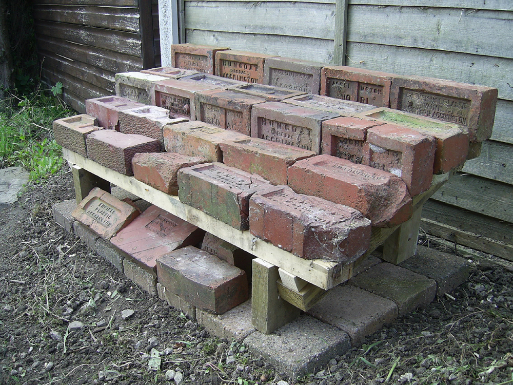
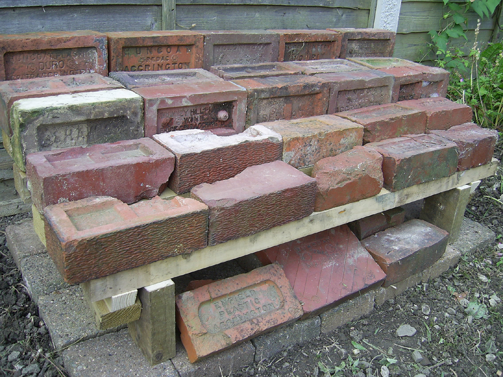
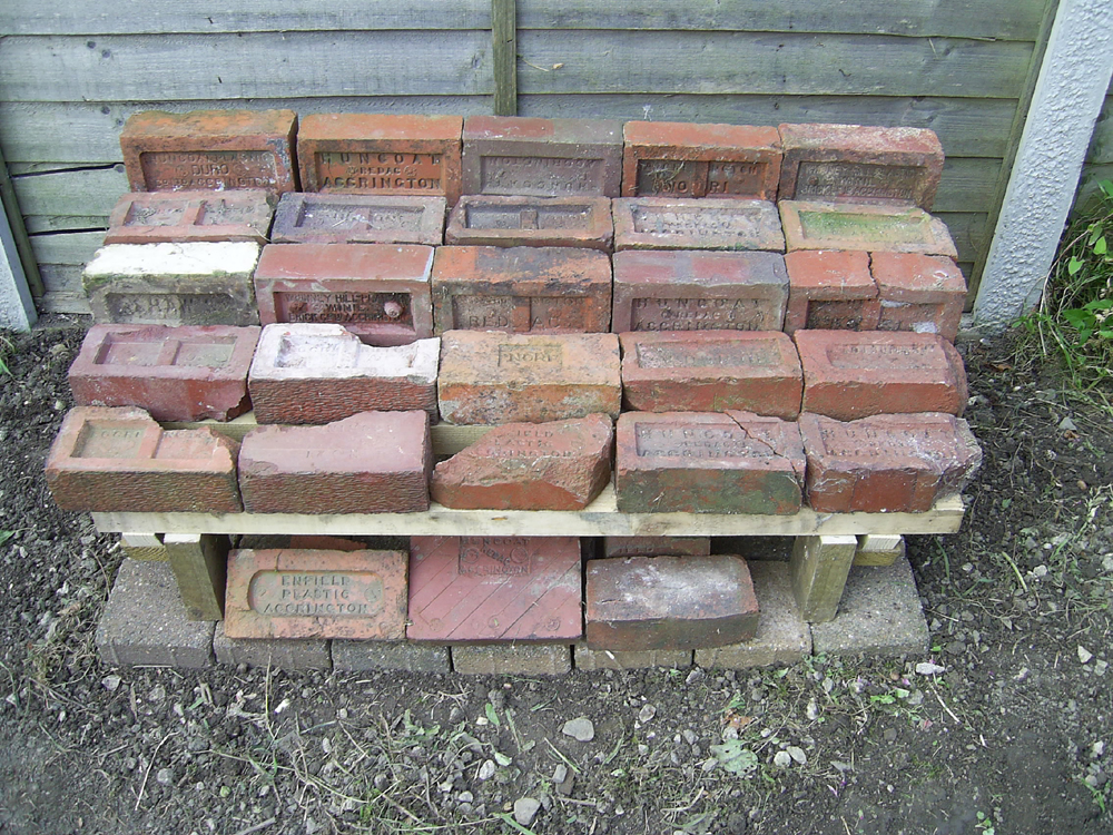
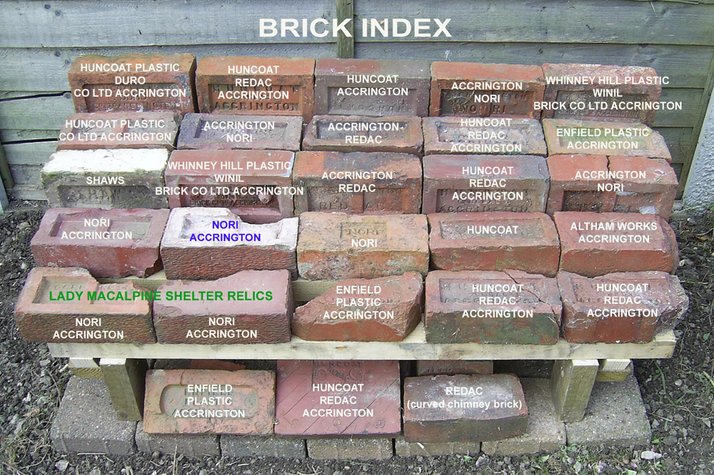
A collection of 30 samples of locally made bricks | |
 |  |
 | 
|
|
* John Hacking of Huncoat invented one of the earliest cotton carding engines * James Hargreaves of Stanhill, Oswaldtwistle invented the Spinning Jenny * John Mercer of Great Harwood invented Mercerisation of cotton cloth making it easier to print and finish * Frederick Steiner of Accrington (born Alsace) improved the dyes for printing * Robert Peel set up a calico printing works at Church and established Hyndburn as the major centre for textile printing * Jonathan Peel established several textile works in the Hyndburn area including Oakenshaw and Broad Oak. The latter passed into the hands of the firm Fort, Taylor and Bury but when Mr. Taylor retired Thomas Hargreaves became a partner and eventually acquired the whole business. (He was not from the same family as James Hargreaves; inventor of the Spinning Jenny.) It was at Broad Oak under the firm Hargreaves Brothers that Polyester was discovered and Terylene invented by JR Whinfield and JT Dickson around 1941. * John Blake of Hyndburn developed the hydraulic ram * James Arkwright of Preston invented the water frame for spinning yarn * John Kay of Bury invented the flying shuttle for weaving * John Bullough (of Howard and Bullough) bought the Isle of Rhum off the Scottish coast near Mallaig in 1886 for the sum of £35,000. In 1897 his son George Bullough commissioned the building of Kinloch Castle on the island. In 1957 Lady Monica Bullough sold the island to the nation for £23,000. It is now a National Nature Reserve. |
|
Water courses (rivers and streams) invariably formed the ancient administrative boundaries.
Warm Leaf Brook flows northward off the Coppice down the clough of the same name and under Burnley Road and Woodside Road flats. Beneath Bolton Avenue playing fields it is culverted until it emerges near a little concrete bridge. Beyond in the marshy ground underneath electricity pylons it meets Spout House Brook. Spout House Brook springs from the old Rake Head quarries and goes under Burnley Road just west of Wedgewood Road. It can be seen in the gardens of several houses on Woodside Road before it decants into Spout House woodland. After passing through the old brick works pond it meets Warm Leaf Brook and becomes Clough Brook (known locally as Tom Brook) turning northwards under the railway line.
Another stream which I call Laneside Brook because that is where it seems to spring from, flows north eastwards via Sankey House Farm and is partly culverted running alongside Whinney Hill Road but emerges under the bridge at the bottom of Bolton Avenue. Beside Enfield Road in front of Oak Bank Terrace it joins the other streams forming Clough Brook and then flows north easterly below the old colliery site down to Waterside on the canal. Here it goes under a small aqueduct for the canal trending northwards through the deep and wooded Altham Clough Wood. At Syke Side Bridge it becomes Syke Side Brook for a short distance before issuing into the River Calder at Dunkirk.
Another major stream, for which the name Hameldon Brook seems apt name comes off Great Hameldon beside Windy Harbour and falls down through Cronker Plantation to an old reservoir at Childers Green. Then it enters Castle Clough Brook to make its way down into the River Calder at Fenny Fold.
|
|
Many streams and brooks come together to form the Hyndburn. It starts to take that name between Church Street, Oak Street and Cross Street and is culverted under Warner Street, Peel Street and Broadway. It emerges under the railway viaduct roundabout and then runs alongside Hyndburn Road to Church, the Dunkenhalgh and Clayton. It joins the Calder at Martholme. Pleck Brook rises under the Coppice and comes down under Water Street to join the Hyndburn under Broadway. There are springs near Miry Farm behind the Coppice which feed the reservoirs above Plantation Road. These in turn decant into Plantation Brook. Plantation Brook rises on Moleside Moor and flows through Brocklehurst Wood passing north of Arden Hall and below Hodder Street and Cedar Street. Once it reaches Washington Street it is called Accrington Brook and joins Pleck Brook under the bottom of Water Street. Warmden Brook rises on Black Moss and comes down Warmden Clough to be joined by Tag Clough and Worsley Brook in Broad Oak and then becomes the River Grange. Woodnook Water rises near Baxenden and comes down through Priestley Clough to meet the River Grange where they both form the Hyndburn. |
| Formation of the park In September 1899 a plan was first mooted for the Borough of Accrington to buy land on the slopes of the Coppice to make a public park. Negotiations took place sporadically over a period of ten years and eventually the Borough decided it wanted to include a parcel of land on the top of the hill. The land belonged to Mr. William Peel of Knowlmere Manor in the Hodder Valley and in 1909 he made a gift to the town of part of the land comprising the Coppice and sold it the rest at a very reasonable rate. As a mark of appreciation to the benefactor the new amenity was to be called "Peel Park". The work of laying out the park was implemented to coincide with periods of depression and so alleviate local unemployment. On 29th September 1909 the park was formally opened with the ceremonial unveiling of a memorial to William Peel. His family originated from Peel Fold, Oswaldtwistle and were notable for Sir Robert Peel the Prime Minster and founder of the Police force. Mr William Peel officially opened the park during a ceremony which included a procession of 5,000 children from local schools, three bands and civic dignitaries walking from Avenue Parade to the top of the Coppice. The schools represented on the procession; Cambridge Street, St Anne's, St Mary Magdalene's, Hargreaves Street, St Andrew's, St Mary's Woodnook, Spring Hill, St John's, Hyndburn Park, Benjamin Hargreaves, St Peter's, St Oswald's, St John's Baxenden, Green Haworth and St James'.
The Monument
*Ashlar Stone
The Centenary
The Shelter
The Trees
The Cannons
The Accrington Pals
The Summit
Hillock Bank |
|
O.S. Maps have always shown a feature on the south-west foot of Great Hameldon labelled May Road Well at a kink in the Huncoat boundary (NGR SD793284). This is an ancient holy well and is infact carved roughly with the words "Mary's Holy Well," although it has also been described as "Mary Hoyle Well." It is a natural spring covered by a 7 inch thick stone slab, 94 inches long and 51 inches across. It may be significant that The Virgin Mary was celebrated by the Catholic Church in May and that this May Road well being situated only 440 metres off the Kings Highway beside a junction track leading over to Loveclough, Dunnockshaw and Goodshaw in Rossendale was well frequented by travellers in bygone days. Up until the end of the 18thC places like Mary's Holy Well were places of pilgrimage and fairs on the first Sunday in May. Today, like thousands of others in the British Isles it is rather neglected and overgrown and it is believed that the spring water was long ago diverted to nearby reservoirs. Holy wells were frequently pagan sacred sites that later became Christianised. The term 'holy well' is commonly employed to refer to any small water source which has some significance in the folklore of the area where it is located, whether in the form of a particular name, an associated legend, the attribution of healing qualities to the water, the belief in the presence of a guardian spirit or Christian saint, or a ceremony or ritual centred on the well site. |
 Site Map |
|